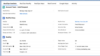
What is GeoData?
GeoData is what’s missing in your CRM data.
It creates a geographic context for all you records in Salesforce.
Leads and Accounts can automatically be assigned to sales teams and Salesforce Users, based on territories and local market conditions.
GeoData creates a multilayered geographic data structure, allowing for instant drill-down into your Salesforce records, unlocks possibilities for automation in Salesforce, making it possible for your team to connect faster with customers.

Why is GeoData critical?
Without a platform of location-data to fall back on, your data records in Salesforce will quickly become inconsistent.
For example, if you only use city and state datapoints today, misspellings and abbreviations will make your data inconsistent. So when running campaigns or researching prospects, your team will miss many opportunities because of data inconsistency.
GeoData makes your Salesforce data better by:
- Automating ownership of leads, accounts, opportunities and more.
- Enhancing search functionality, plus nearby search and reporting
- Including critical geographic datapoints for customer segmentation.
- Adding a geographic data structure, making drill-down analytics a reality.
For example, if you’re helping your sales team to find new prospects in their respective areas, it often turns into an unsuccessful search by city.
Empower your team to run geo-targeted marketing and sales activities:
But, if you implement the GeoData platform, you can empower your team to drill down into leads by territory, state, MSA metro, county, city and zip code. Your team will even be able to run lead reports by distance from their starting point, focusing on areas with the best possible market conditions.
How does GeoData accelerate success?
Now that we know what GeoData is and why it’s important, let’s take a look at how you can enhance your data even further:
By purchasing datasets such as business count, competitive data, demographics or any other business-related datasets, you’re adding your descriptive market conditions into your GeoData Platform. When automatically combining your own CRM data with deep GeoData, you’re empowering your team with actionable insights.
For example, let’s say you’re planning on opening your next cosmetic surgery clinic.
RealZips RealDatasets make it possible to:
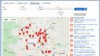
- Review visual maps of existing healthcare providers that can refer patients.
- Current competitive locations in the area you’re considering.
- Calculate distance to nearby hospitals.
- Get population count within 20 miles.
- Review household income in surrounding areas.
So, if you’re finding multiple health companies in the area, as well as consumers with high-income levels – this could be an opportunity for further research a location your cosmetic surgery business in the area.

How Are RealZips Customers Using GeoData?
One customer is using GeoData to accelerate time-to-close within Salesforce. They’re now able to focus on leads within pre-qualified zip codes or counties. This allows them to do more targeted marketing and sales in areas that will generate a higher return in new customers and revenue.
Another customer is using GeoData to automate their lead routing process, in order to immediately follow-up to new leads – long before their competition will be able to react.
The use of GeoData is highly customizable allowing for endless use cases for any location-based marketing, sales and support process.

Ready to Learn More about GeoData and How it Can Help Your Business?
If you’re looking for more tips on how to use GeoData, or want to know about our deep datasets and how they can help your business grow, contact us today. We love talking about data – especially when it comes to helping marketing and sales teams succeed.